How Large Is Udzungwa National Park?
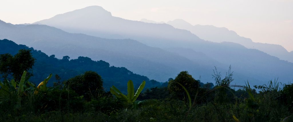
Udzungwa Mountains National Park covers 1,990 square kilometres, or about 770 square miles, which places it in the middle of Tanzania’s park network by area. It rises from around 250 metres at its lowest to roughly 2,576 metres at Luhombero Peak, and has no interior roads, so its size is experienced on foot rather than from a vehicle. The park sits in south central Tanzania and protects the largest forest block in the Eastern Arc chain.
The number matters less than what it contains. Nearly two thousand square kilometres with not a single road through it is an unusual thing to find anywhere in East Africa.
The Park Area in Square Kilometres and Miles
One thousand nine hundred and ninety square kilometres is the figure Tanzania National Parks uses, equivalent to about 770 square miles. Some sources round it to 2,000, which is the same number wearing a different hat.
To put that in context, it is roughly the size of a small English county, or a little over half the area of Mikumi next door. Twenty percent of the park lies in Morogoro Region and the remainder in the southern highland region of Iringa, split across the Kilombero and Kilolo districts. Whether a source files it under Iringa or Morogoro tends to depend on which portion the compiler was looking at.
How the Park Compares with the Wider Udzungwa Range
The national park protects only part of the mountains. The Udzungwa range as a whole covers something in the order of 16,131 square kilometres, making it the largest block in the entire Eastern Arc chain, which runs from the Taita Hills in Kenya down through Tanzania.
So the park is a fraction of the range, roughly an eighth of it. The rest is a patchwork of forest reserves, village land and farmland. Satellite analysis has found around 1,353 square kilometres of the mountains still under evergreen forest, which is the figure that matters ecologically far more than the park boundary does.
The Vertical Range from 250 to 2,576 Metres
Area only describes half of it. The park climbs from about 250 metres in the Kilombero Valley to roughly 2,576 at Luhombero Peak, with Mwanihana, the second summit, near 2,150.
That vertical spread is what makes a Udzungwa hiking safari unlike walking in a flat reserve of similar size. Forest runs unbroken up the whole gradient, which is rare in African mountains where the lowland belt has usually been cleared. Species move between altitudes rather than sitting marooned in fragments, and a single trail passes through several distinct habitat bands.
How Much of the Park Is Actually Walkable
The established trail network is small relative to the area. Prince Bernhard runs about a kilometre. Sonjo covers three. The Sanje circuit is three and a half to six kilometres, Njokamoni roughly six and a half, Mzimu sixteen, the Hidden Valleys circuit seventeen and Njia Panda twenty six.
The long routes are the Mwanihana trail at 38 kilometres and the Lumemo at 65. Add those together and the marked network amounts to a couple of hundred kilometres at most across a park of nearly two thousand square kilometres. Everything else is forest with no path, reached only on expedition routes such as the Luhombero climb, which takes five to seven days.
Udzungwa Compared with Other Tanzanian National Parks
Size alone tells you very little about a visit. Udzungwa is smaller than Mikumi and takes far longer to see properly, because three kilometres of forest trail is a morning while thirty kilometres of park track is an hour in a vehicle.
How Long It Takes to Cross the Park
Nobody crosses it casually. The Lumemo Trail, at 65 kilometres over four or five nights, starts beyond Ifakara on the Lumemo River and returns along the Mwanihana side, and that is the closest thing to a traverse on the established network.
The Luhombero expedition goes deeper, five to seven days depending on where you start, with the longer version coming in from Dabaga near Iringa on the western highlands side. Both require porters, a cook and an armed ranger, and camps are chosen around water rather than distance. In a park with no evacuation road, size translates directly into commitment.
What Fits Inside the Park Boundary
Within those 1,990 square kilometres sit tropical rainforest, montane forest, miombo woodland, grassland, steppe and bamboo, plus rivers, gorges and waterfalls including Sanje at roughly 170 metres across three tiers.
Biologically the density is out of proportion to the area. Around 400 bird species, some 2,500 plant species with roughly a quarter endemic to the Eastern Arc, twelve primate species and twenty vertebrates found in this mountain block and nowhere else. The park has been described as holding between thirty and forty percent of Tanzania’s plant and animal species.
Why the Park Feels Bigger Than Its Area
Three things do it. There is no vehicle access, so you cover ground at three kilometres an hour instead of thirty. The terrain is vertical, which turns a short map distance into a long day. And visitor numbers are very low, with figures suggesting an average of under thirty people a day across the whole park.
Walk four hours up the Sanje trail and you will have covered perhaps five kilometres of a park nearly two thousand square kilometres in extent, seen almost nobody, and looked out over an interior that has no path in it. Few places manage that.
How the Size Shapes a Visit
Practically, the park’s area does very little for a two day visitor and everything for a trekker. Someone doing Sanje and a short walk covers perhaps ten kilometres across two mornings, all of it within a narrow strip near the eastern boundary, and sees a genuinely representative slice of the forest.
The scale only becomes real on the long routes. Three days into the Mwanihana trail you are walking country where the nearest road is a day away in any direction, and the plateau rolls on northwest with no path, no village and no sign of anyone. That is what nearly two thousand roadless square kilometres actually feels like, and it is the reason people who trek here describe the park differently from people who day hike it.
Best Time to Explore the Larger Routes
June through October is when the long distances become practical, since plateau ground drains and the multi day treks run reliably. The short trails near the gate work in any season.
Where the Park Sits Among Tanzania’s Protected Areas
Tanzania protects a very large share of its territory, and Udzungwa is a mid sized entry in a network that runs from tiny island parks to reserves covering tens of thousands of square kilometres. Saanane Island is measured in hectares. Nyerere is measured in a figure most people cannot picture.
What lifts Udzungwa above its rank by area is what sits inside the boundary. The park is credited with the second highest biodiversity of any national park in Africa and is treated as one of the world’s biodiversity hotspots and a globally important ecoregion. On a list ordered by size it appears unremarkable. On a list ordered by species found nowhere else, it sits at the top of the Tanzanian network.
Getting to Udzungwa Mountains National Park
The headquarters at Mang’ula sit on the road between Mikumi town and Ifakara, about 60 kilometres and ninety minutes from Mikumi. Dar es Salaam is five to six hours away via Chalinze, Morogoro and the highway that crosses Mikumi National Park, with tarmac ending at Kidatu and graded dirt covering the last 24 kilometres. Iringa lies two to three hours southwest.
The TAZARA train stops at Mang’ula station and Ifakara buses pass the gate. All registration, fee payment and guide allocation happen at the headquarters before any walking begins.
Frequently Asked Questions About Udzungwa’s Size
Does the park’s size affect what it costs to visit?
No. The conservation fee is charged per person per 24 hours regardless of how far you walk, at 30 US dollars for non resident adults, roughly 35.40 with value added tax. Children between five and fifteen pay about 10 dollars. What costs more is time: long routes need multiple days of fees plus camping charges at around 35.40 per person per night, which is why a Mwanihana trek runs 400 to 500 dollars per person all in.
How big is Udzungwa exactly?
1,990 square kilometres, or about 770 square miles. Roughly a fifth of that lies in Morogoro Region and the rest in Iringa. The wider Udzungwa mountain range, most of which is outside the park, covers something like 16,131 square kilometres and is the largest block in the Eastern Arc chain.
Is Udzungwa bigger than Mikumi?
No. Mikumi covers about 3,230 square kilometres and is Tanzania’s fourth largest national park, while Udzungwa is 1,990. Udzungwa takes considerably longer to see, though, because everything happens at walking pace instead of driving pace.
How much of the park can visitors reach?
A small fraction. The established trail network totals a couple of hundred kilometres at most, all of it in the eastern strip near the gate. The interior has no paths and is reached only on expedition routes such as the five to seven day climb to Luhombero.
How long is the longest trail?
The Lumemo Trail at 65 kilometres, walked over four or five nights from beyond Ifakara. The Mwanihana route comes next at 38 kilometres over two or three days. Day walks range from a one kilometre stroll to the seventeen kilometre Hidden Valleys circuit.
Is the whole park forested?
No. Tropical rainforest and montane forest dominate the eastern side, while the western part carries highland grassland, and miombo woodland fringes the lower edges. Satellite work has put evergreen forest cover across the wider mountains at around 1,353 square kilometres.
Booking Your Udzungwa Trip
The safari companies and tour operators listed on this website put trips like this together for a living and know which camps, guides and routes actually deliver. We are an independent guide to Udzungwa; we do not book or sell tours ourselves.
When you are ready, arrange your safari, tour or holiday with one of the recognised operators listed here. Tell them your dates and what matters most, and a real person, not a form, will handle the itinerary, park bookings and logistics for you.