Mwanihana Trail
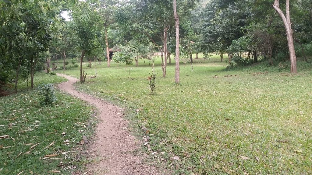
The Mwanihana Trail is a 38 kilometre trekking route through Udzungwa Mountains National Park, walked over two or three days from Sonjo village to the ridge below Mwanihana Peak and back. Bookings run through the park headquarters at Mang’ula or the forest camp on the boundary, and every party travels with a guide, an armed ranger and porters. Udzungwa is a rainforest park in south central Tanzania with no interior roads at all.
Ask anyone who works at the gate which trail they would walk on a free week and this is the answer you get. It crosses six habitat types, climbs from about 300 metres to over 2,100, and passes through country nobody visits.
The Mwanihana Trail Trekking Route in Udzungwa Mountains National Park
Distance is the headline: roughly 38 kilometres out and back, making this the longest of the park’s established routes apart from the five day Lumemo Trail. Height gain is the real work, though, since the path starts in hot lowland woodland near the plain and finishes among bamboo and heather on an exposed ridge.
Three campsites sit along the way. The first, at Njia Panda, has a ranger post and stands at around 900 metres, about three hours in from the trailhead. The second is often occupied by researchers working in the forest. The third sits higher and serves parties splitting the walk differently. Your guide decides which combination fits your schedule and the water situation.
Day One on the Mwanihana Trail: Sonjo Village to Njia Panda
The Mwanihana trekking route begins at Sonjo village, a short transfer north of the park headquarters, where porters join and loads are divided. The first section shares its path with the short Sonjo waterfall walk, passing two cascades before the day trippers turn back and you carry on.
From there the climb is steady rather than steep, with a few sharper pitches interrupting an otherwise even rise from around 300 metres to the 900 metre campsite. Three hours covers it at a working pace. Miombo woodland gives way to lowland forest as you gain height, and the temperature drops enough to notice by the time camp is set.
Afternoons at Njia Panda are quiet. Most people wash in a stream, eat early and sleep before nine.
Day Two of the Mwanihana Trekking Safari: The Plateau and the Ridge
This is the long day and the good one. The path climbs out of closed forest into grassy plateau, much of it open ground flanked on both sides by tall trees, and this is where elephant sign becomes obvious. Tracks in the mud, broken branches, dung on the path. Sometimes the animals themselves.
Higher up, submontane forest turns into proper montane forest, then bamboo, then heather and bare rock at the top. The change happens fast at the end. From the ridge, when cloud allows, the Kilombero Valley spreads out to the southeast with the plain running on towards Nyerere National Park, and the trackless plateau rolls away in the other direction.
Groups on the two day schedule summit and descend on the same day, which makes for ten hours or more on foot. Those on three days return to camp and take the descent fresh.
Day Three: Descending the Mwanihana Hiking Route
Down is not the easy half. The same gradient that felt manageable with fresh legs works on the knees on the way back, and the lower forest sections are humid enough that people arrive at Sonjo wetter than they were at the summit.
Wildlife often improves on the descent, mainly because groups have stopped talking by then. Red duiker cross the path. Monkeys feed in the mid canopy and take less notice of a quiet party. Guides who are enjoying themselves will make several unscheduled stops in the last two hours, and it is worth going along with them.
A vehicle collects at Sonjo and returns you to the headquarters or your lodge.
Habitat Zones Crossed on the Mwanihana Trail
The reason this walk matters ecologically is compression. The Eastern Arc mountains have held forest for something like thirty million years, and Udzungwa is unusual in keeping that forest continuous from the lowlands to the summits rather than in isolated patches. Walking this trail takes you up that gradient in one go.
Camping and Support Crew on a Mwanihana Trail Trek
Nothing on this route is self service. A cook travels with the group and works over a fire. Porters carry tents, food and cooking gear, while you carry water, layers and a camera. Equipment is hired through the forest camp at the boundary unless you brought your own, and the camp team sets up and breaks down each site.
Sleeping is under canvas at forest campsites with no facilities beyond what the crew brings. Streams provide water, treated before drinking. Nights are colder than most visitors expect, particularly from June to September when the upper camps drop towards nine degrees. A proper sleeping bag rather than a liner makes the difference between resting and enduring.
Why an Armed Ranger Walks the Mwanihana Trail
Elephants use this trail. So do buffalo. Both are common on the grassy plateau sections in the middle of the route, and thick forest means you can meet one at short range with little warning. TANAPA requires an armed ranger with every trekking party, and the fee is charged per day alongside the guide’s.
Rangers set the walking order, decide when to hold position and when to back off, and they are not open to discussion on it. Leopard are present in the park too, though sightings are so rare that nobody plans around them. In practice the ranger spends most of the trek reading tracks and pointing out things the guide has missed.
Packing for a Multi Day Mwanihana Trekking Trip
Best Months for Walking the Mwanihana Trail
June to October is the trekking season and everything about the route works better in it. Plateau sections drain, stream crossings drop, and clear summit mornings become likely rather than lucky. The trade is cold nights and the busiest weeks for accommodation near the gate.
Getting to the Mwanihana Trail Start
All trekking parties register at the park headquarters at Mang’ula, beside the road running from Mikumi town to Ifakara, then transfer the short distance to Sonjo village where the trail begins.
Mang’ula is five to six hours from Dar es Salaam via Chalinze, Morogoro and the highway that cuts through Mikumi National Park. From Mikumi the drive is around 65 kilometres, roughly ninety minutes. Iringa is two to three hours away to the southwest. The TAZARA train stops at Mang’ula station and Ifakara buses pass the gate. Plan to arrive the day before so the briefing, kit check and porter allocation happen without a rush.
Frequently Asked Questions About the Mwanihana Trail
What does the Mwanihana Trail cost?
Between 400 and 500 US dollars per person for a two or three day trek including guide, armed ranger, porters, cook, equipment hire, food and park fees. Groups pay less per head. Behind that figure, the conservation fee is 30 US dollars per person for each 24 hour period for non residents, around 35.40 with value added tax, and camping inside the park adds about 35.40 per person per night.
How long is the Mwanihana Trail?
Roughly 38 kilometres as a round trip from Sonjo village, climbing from about 300 metres to the ridge below Mwanihana Peak at around 2,150. Two days and one night is the fast version. Three days and two nights is the comfortable one and what most guides recommend.
Are porters included?
They are part of every organised trek on this route and their fee sits inside the package price. Porters carry tents, food and cooking equipment. You carry water, layers and whatever you want to hand. Tipping at the end is customary and separate from the quoted cost.
Can I sleep in huts instead of tents?
No. There is no built accommodation anywhere on the trail. Njia Panda has a ranger post but trekkers camp, and the higher sites have no structures at all. Everyone sleeps under canvas, which is part of why the crew is as large as it is.
Are elephants dangerous on this trail?
They are wild and unhabituated, which is exactly why an armed ranger is compulsory. Close contact is managed by keeping distance, staying quiet on the open plateau and following the ranger’s instructions without debate. Groups walk this route regularly without incident, and the precautions are the reason for that.
Is the trail marked?
Partly, and not reliably. Sections through grassland grow over between seasons and junctions are not always obvious. That is one reason self guided walking is prohibited across the whole park. Your guide navigates and also carries the radio contact with the headquarters.
Booking Your Udzungwa Trip
The safari companies and tour operators listed on this website put trips like this together for a living and know which camps, guides and routes actually deliver. We are an independent guide to Udzungwa; we do not book or sell tours ourselves.
When you are ready, arrange your safari, tour or holiday with one of the recognised operators listed here. Tell them your dates and what matters most, and a real person, not a form, will handle the itinerary, park bookings and logistics for you.